


Emergency response analytics

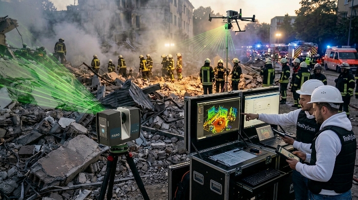
Real-time 3D scanning of the incident zone for emergency response

Colorized point clouds and a 3D map of the incident zone for coordinating rescue operations in near real time.

In emergencies, speed and data reliability are critical. We build a digital situational model for command posts and crews: from initial scanning to delivery on tablets and laptops.
Positioning: down to 1 cm Density: from 10 million points/ha Delivery: < 5 sec with stable connectivity Operation in smoke and low visibility
Operational analytics for emergency and rescue services

How it works at the emergency site

The system combines mobile and aerial scanning, cloud transfer and semantic analysis of hazardous zones so rescue units work from a digital model rather than “blind”.

1. Data capture

Mobile scanners and UAVs with LiDAR/RGB capture the scene from multiple positions.

2. Processing and stitching

Noise filtering, scan registration, synchronization of geometry, RGB and thermal imagery.

3. Semantic analysis

Automatic highlighting of critical zones: debris, deformations, elevated-temperature hotspots.

4. Command post delivery

Export to GIS/emergency systems and streaming to operational team devices.

Key system parameters

1 cmpositioning accuracy
10+ mln/hapoint cloud density
< 5 sdata transmission latency
48 MPRGB modeling and color fidelity
24/7operation in harsh weather and visual conditions

What the client gets

  • A 3D map of the emergency zone with color coding of hazardous areas.
  • Remote object inspection without risk to personnel.
  • Planning of evacuation routes and access to critical points.
  • Automatic alerts on critical changes.
  • A scan archive for reporting, insurance and subsequent analysis.

Technologies and standards

  • MLS, UAV with LiDAR and RGB, SLAM, thermal imaging.
  • Integration with ArcGIS, QGIS and emergency management systems.
  • Delivery formats: .e57 .las .laz .rcproj .fbx .obj .glTF .tiff .pdf
  • GOST R 59562-2021, EMERCOM requirements, RSES data exchange protocols.

Application areas

  • Search and rescue after collapses, explosions, earthquakes.
  • Fire monitoring, including forest and industrial fires.
  • Assessment of flood and inundation consequences.
  • Inspection of damaged infrastructure: bridges, roads, power lines.
  • Coordination of EMERCOM, emergency services and volunteer groups.

Final step

We will prepare a working procedure: mobile crew composition, deployment scenario, data format for your command post and integration into existing digital systems.